Large Control Net Work Post Processed Receivers and Software
Single-Beam and Multi-Beam Hydrographic Systems
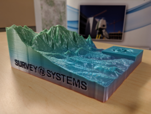
High-Definition Surveying with 3-D Laser Scanner
Traditional and High Precision Digital Leveling
Digital Data Collection for all Crews
Computer-Aided Drafting with Automatic Data Compilation
Computer Generated Maps and Plotting Compatible with all GIS Systems
All Crews are Fully Digital and Mobile
AutoCad Civil 3D
Trimble Business Center
Trimble Real Works
Applanix POSPac
Leica Cyclone point cloud processing
Hypack Max / Hysweep Hydrographic Software
AML Seacast
OPS Hydrographic Software Package
Terrain Navigator Pro
Blue Beam PDF Software
Complete Digital Drafting Capabilities in all Formats
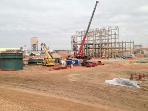
High Precision Construction Control and Layout
Steel Control and Installation Verification
Foundation Control for Large Precast Projects
Maintaining Control on Large Vertical Elements, IE Elevator Shafts, Foundation Walls, Building Compression Monitoring and Steel
LAND DEVELOPMENT SURVEYING
ROAD WAY CONSTRUCTION
DESIGN SURVEY
Design Topographical Surveys
As-Builts
Building Layout
Curb and Gutter
Design Surveying
Foundation Surveys
Overlot
Pipe Layout
Platting
Photogrammetric Support
Property Line Location and Monumenting
Roadway
Single and Multi-Family Subdivisions
Topographic Surveys
Establish project control
Site Verification
Excavation Grading
Erosion Control Layout
Subgrade Layout and Verification
Pavement Layout and Verification
Roadway Layout and Construction Staking
Minor/Major Infrastructure Staking
Large Structural Control and Layout, IE Bridges
Right-of-Way and Fencing Layout
Traffic Control Layout
Pavement Marking Layout
Aliquot Corner Recovery Rehabilitation Restoration to Comply with Current Manual of Instructions and C.R.S. 38-53
State Plane Coordinate System Ties to N.G.S. Colorado H.A.R.N. with Data Conversions from Grid to Ground with Combined Scale Factors
SUE Subsurface Utility Engineering support surveys
Topographic Survey
Wet Utility As-Built Survey Including: Sanitary, Storm Water and Reclaimed Water
Dry Utility As-Built Survey Including: Fiber Optic, Telephone, Cable, Gas and Electric
Route Surveying
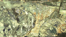
HYDROGRAPHIC / BATHYMETRIC SURVEYING
GEOGRAPHICAL INFORMATION SYSTEMS
Channel Clearance Surveys
Construction Support
DAM Monitoring
Dredging Support Surveys and Pay Quantity Verification
Single-Beam & Multi-beam Surveying
Stage Capacity Surveys
Sub-bottom Profiling
Volumetric Surveys
Underwater Search Capabilities
Underwater Structure Engineering Support
Water Way Cross Section Acquisition
GIS Meta-Data Acquisition
GIS Data Plotting and Delivery to GIS Firms
GIS Data Export from Existing Data Systems
GIS Data Import for Route Planning and Analysis
Channel Cross Section Acquisition Underwater Search Capabilities Underwater Structure Engineering Support Water Way Cross Section Acquisition Construction Support Volumetric Surveys Dredging Support Surveys and Pay Quantity Verification
ENVIRONMENTAL SURVEY
CERTIFICATION SURVEYS
Well As-Built Data and Vertical Control
Slurry Wall Layout and As-Built
Abatement areas Locations and Gridding for Clearance
Staff Gauges and Automatic Data Acquisition Control Surveys